

Watermill in Kalyves
In the centre of the village of Kalyves, over the river, is preserved the village watermill. It dates from the second half of the 16th century. In its present form it has undergone many additions, but the original core of the Venetian period is still visible. It is a vaulted building constructed of stones and strong mortar, in which the mill machinery was placed. Four of the water outlet arches survive today.
This was an important infrastructure work of the Late Venetian period, which also contributed to the development of the area in modern times. Originally a grain mill, it has also served as an olive mill, a motorised grain mill and a hydroelectric power station. It was the first hydroelectric power plant in Chania Prefecture and probably the whole of Crete (1928). It supplied electricity to the village of Kalyves and the neighbouring Izzedin Fortress when this was used as a prison.
The watermill of Kalyves used the water of the River Mesopotamos. It belongs to the Greek or oriental type, as it has a horizontal water wheel connected to the millstone with a vertical shaft. The watermill had four waterwheels and corresponding pairs of millstones. During operation, the water would rush down the wooden waterwheel, making it rotate around its axis and moving the grinding mechanism. The latter consisted of two millstones, the lower one fixed and the upper one moved by the waterwheel shaft to which it was connected. The mechanism had a handle to regulate how finely the grain was ground.
Most Cretan watermills were “one-eyed”, meaning they only had one water inlet. However, in West Crete, and particularly in the Apokoronas region, there are mills with several water inlets in a row, with the same number of grinding mechanisms.
Due to its size, the watermill is depicted on a map of the coastal area of Apokoronas, which also depicts the fortress of the same name (Castel Apicorno), by the Venetian engineer and cartographer Francesco Basilicata (1618). It also appears on several other maps of the Venetian period.
-
- Watermill, Kalyves. The front of the building today (source: Sotiris Zapantiotis).
-
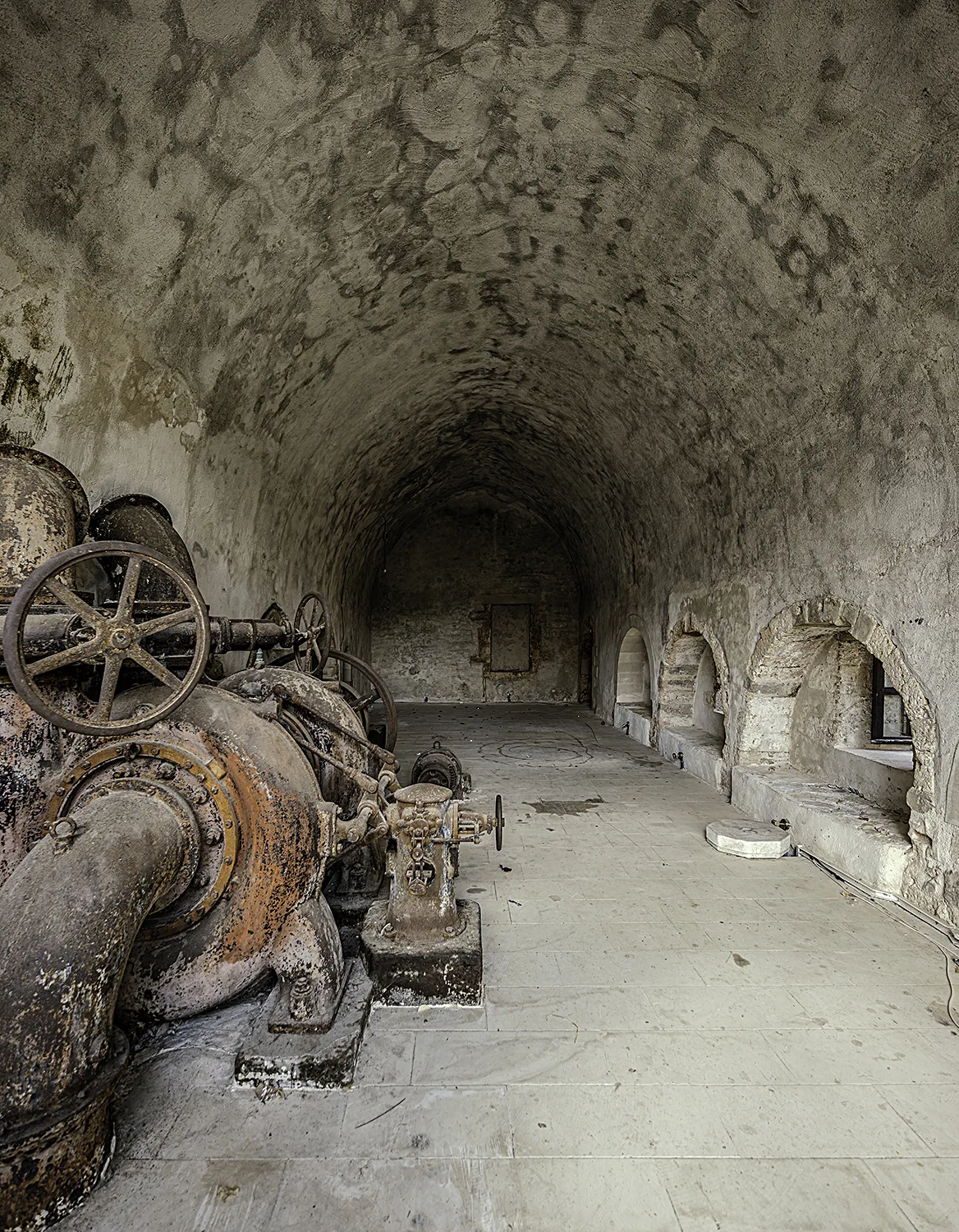
- Watermill, Kalyves. The interior of the building (source: Sotiris Zapantiotis).
 Watermill in Kalyves in the Route of Timelessness
 Watermill in Kalyves in the Route of Water
It was used as an olive mill, a motorised corn mill and even a hydroelectric power plant. It is the most important watermill on the island, not only due to its size but also because of the different ways it has made use of water through the ages.
-
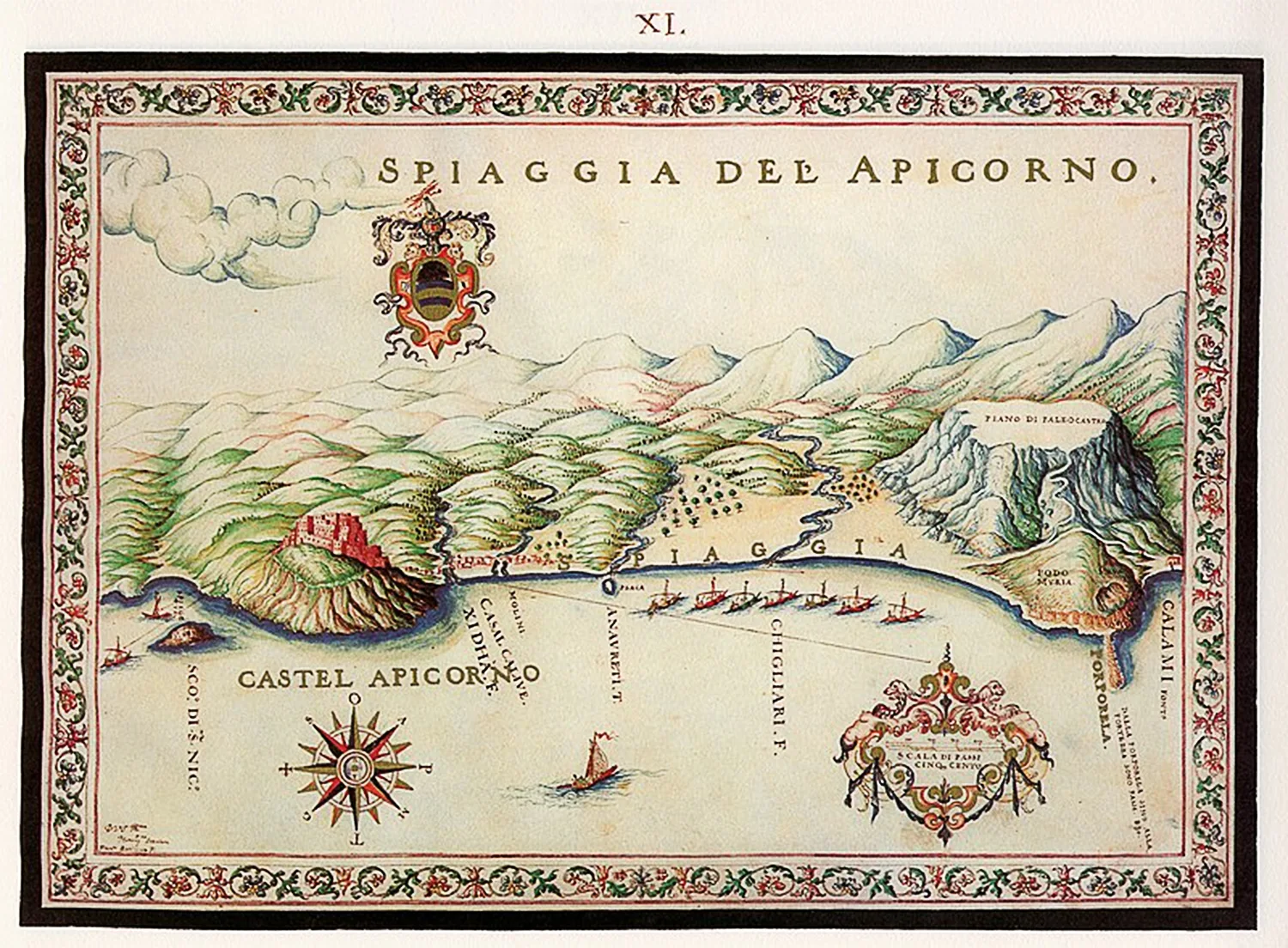
- Map of the beach of Apokoronas by Basilicata, 1618. The Kalyves watermill is visible (source: Wikimedia Commons).
 Watermill in Kalyves in the Route of Sustainability
 Watermill in Kalyves in the Route of Rural Life
Kalyves
Kalyves is a village at the entrance to Souda Bay, crossed by the Xydas River.
It is located near the Chania-Rethymno National Road, 19 kilometers from Chania.