

Wells of the Venetian period in Palailoni
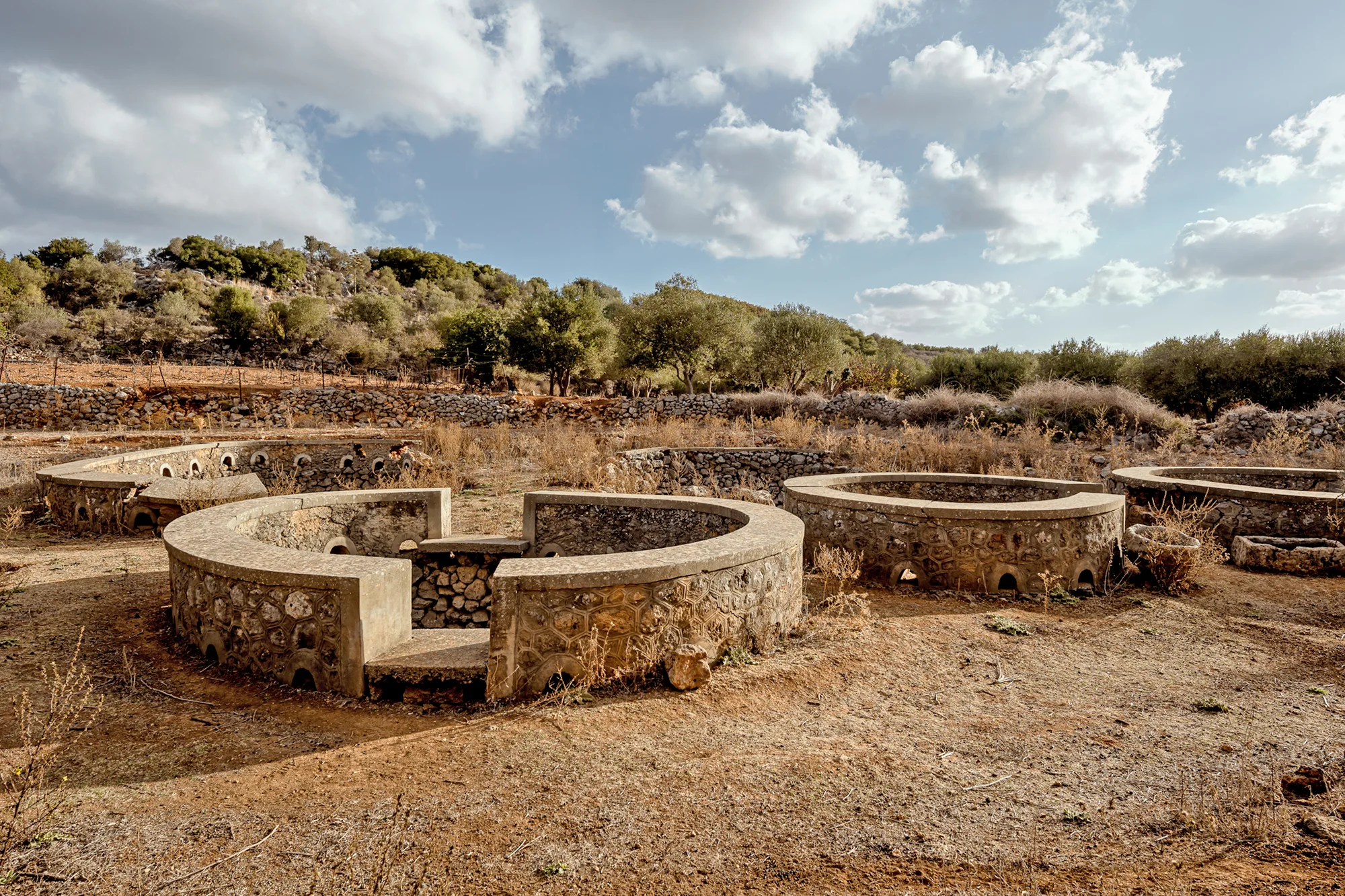
The Lygenia wells are located in a rural setting between the village of Drapanos and Palailoni. They are a group of rainwater collection cisterns. According to the villagers, they were still in use until recently. They provided water for both people and animals, as shepherds gathered there to water their flocks.
The cisterns are roughly circular, varying in size, with a diameter of about 3 to 5 m. They are dry-stone structures built of large undressed stones. A raised rim of stones and thick cement mortar was added, probably in the 19th century. The outside is carved with a pattern of double polygons enclosing stones, a typical feature of the infrastructure works of the Late Ottoman period or that of the Cretan State.
Stone basins are preserved on the site.
The cisterns are located in a depression that is lower than the surrounding rocky masses. For their construction, the site of the wells and the surrounding area was levelled to a depth of about 1-2 m. This created an additional, artificial depression into which rainwater runoff flows. A retaining wall of rubble masonry was constructed to a height roughly corresponding to the top of the concrete rim of the cisterns.
Shepherds from the neighbouring villages gathered here with their flocks.
-
- Wells of the Venetian period, Palailoni (source: Sotiris Zapantiotis).
-
- Wells of the Venetian period, Palailoni. The aboveground mouths of the modern wells (source: Sotiris Zapantiotis).
 Wells of the Venetian period in Palailoni in the Route of Timelessness
 Wells of the Venetian period in Palailoni in the Route of Water
Local residents who remember the site in use say that shepherds from the nearby pastures gathered here to water their flocks, making the wells a social meeting place.
-
- Wells of the Venetian period, Palailoni (source: Sotiris Zapantiotis).
 Wells of the Venetian period in Palailoni in the Route of Sustainability
 Wells of the Venetian period in Palailoni in the Route of Rural Life
-
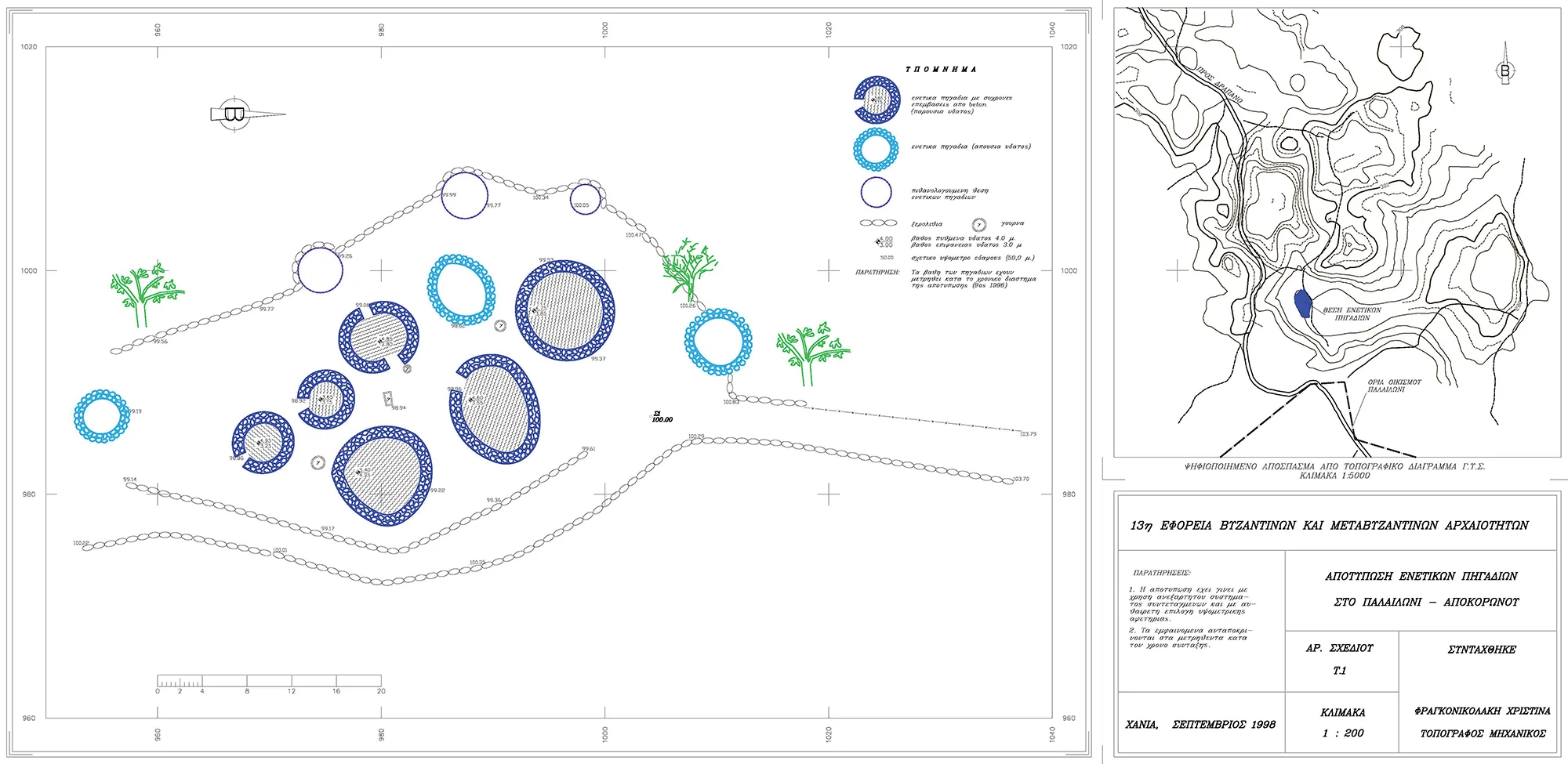
- Wells in Palailoni. Topographical plan showing the distribution of the wells (source: Ministry of Culture, Ephorate of Antiquities of Chania).
Palailoni
Palailoni is a mountain village in Vamos Apokoronas, at an altitude of 500 meters and 28 km from Chania.